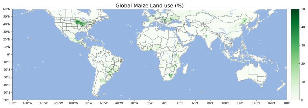
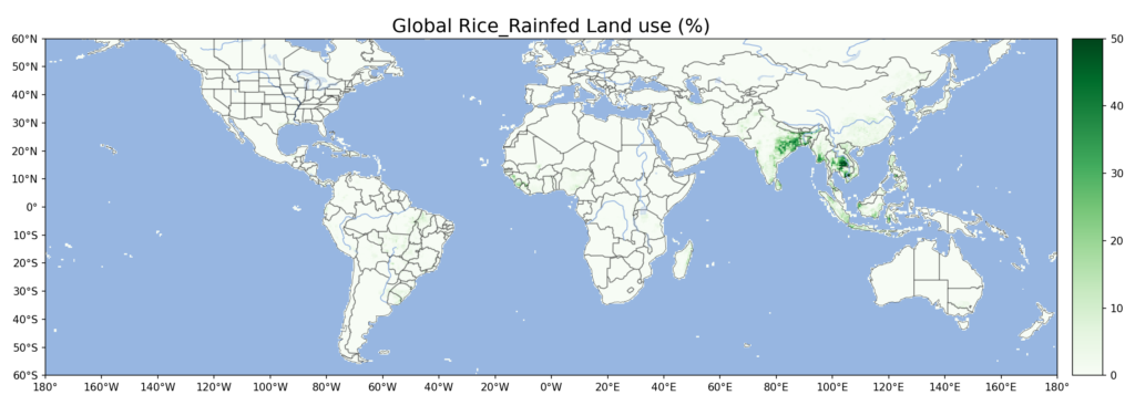
Global maps of major crops for reference. These maps are plotted based on ISIMIP2b’s land use data. for the period of 2005-2014. Only rainfed land use for crops is mapped.These maps are for personal reference only, please do not cite them.
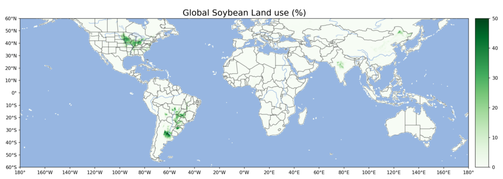
Global maps of major crops for reference. These maps are plotted based on ISIMIP2b’s land use data. for the period of 2005-2014. Only rainfed land use for crops is mapped.These maps are for personal reference only, please do not cite them.